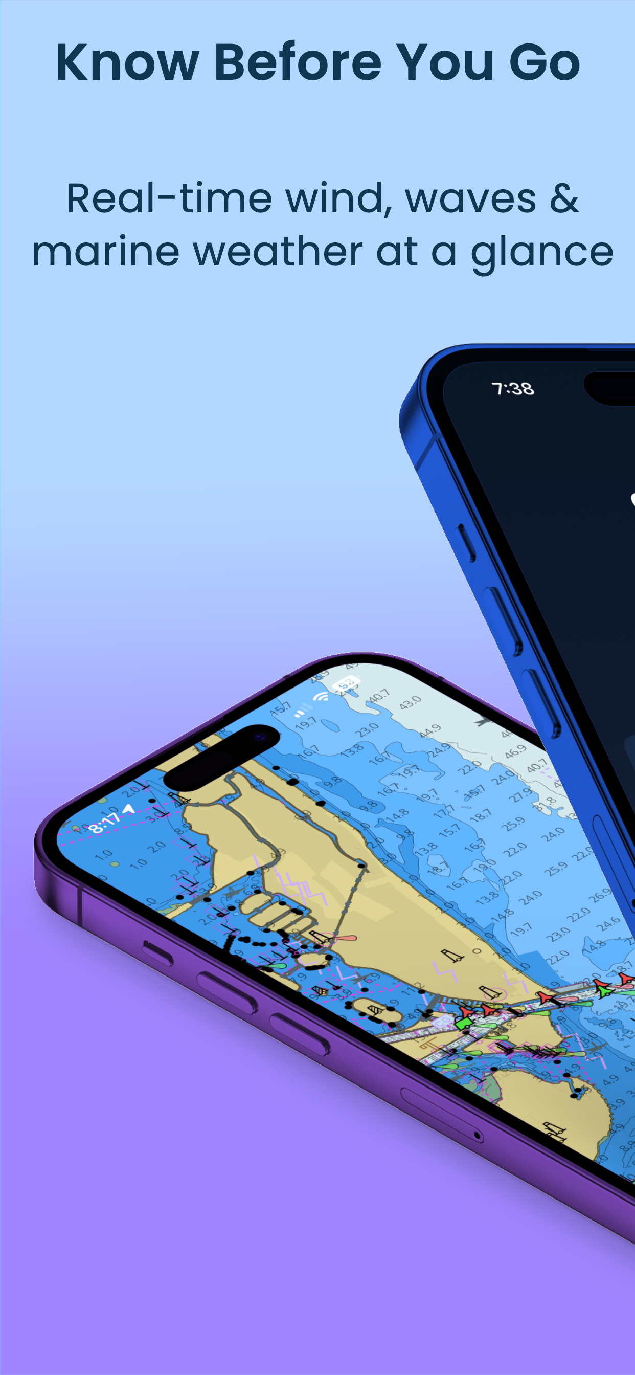
Know Before You Go
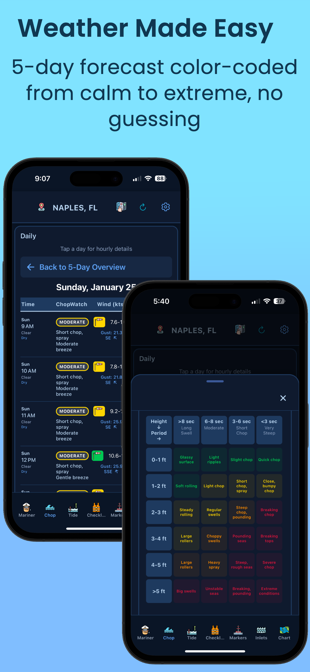
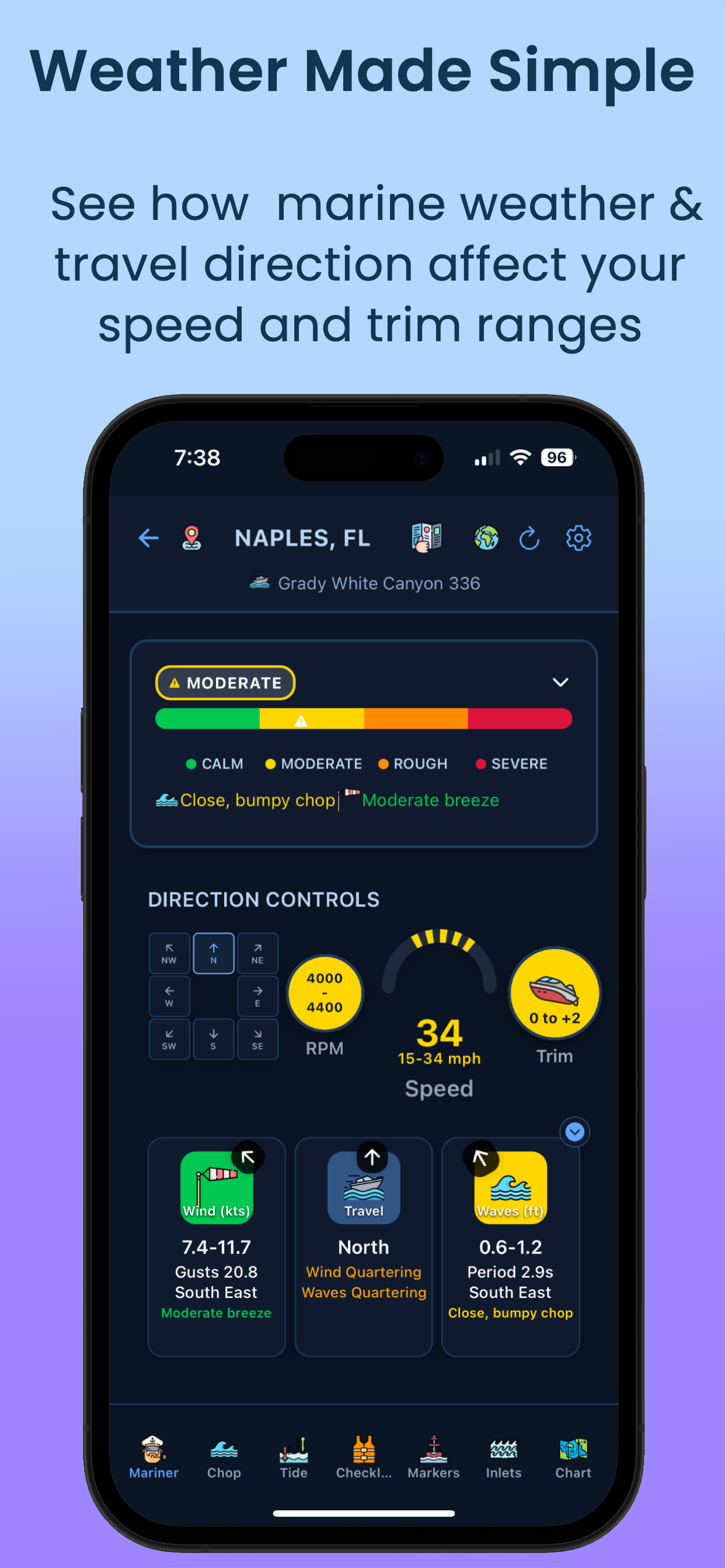
Color-coded marine weather that anyone can understand. No more guessing what 15 knots NNE means for your boat.
 60-minute free trial
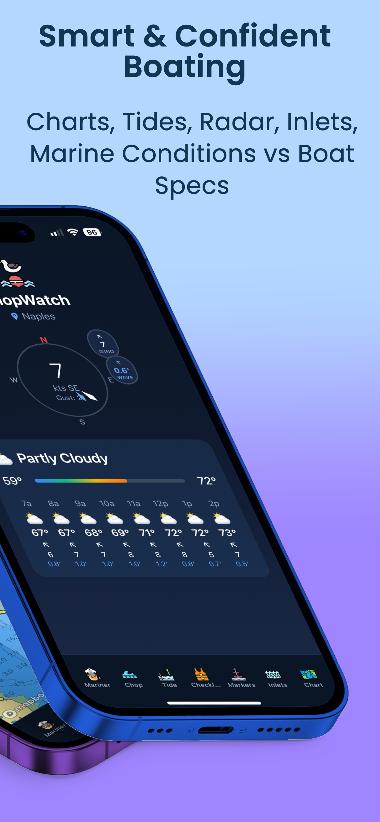
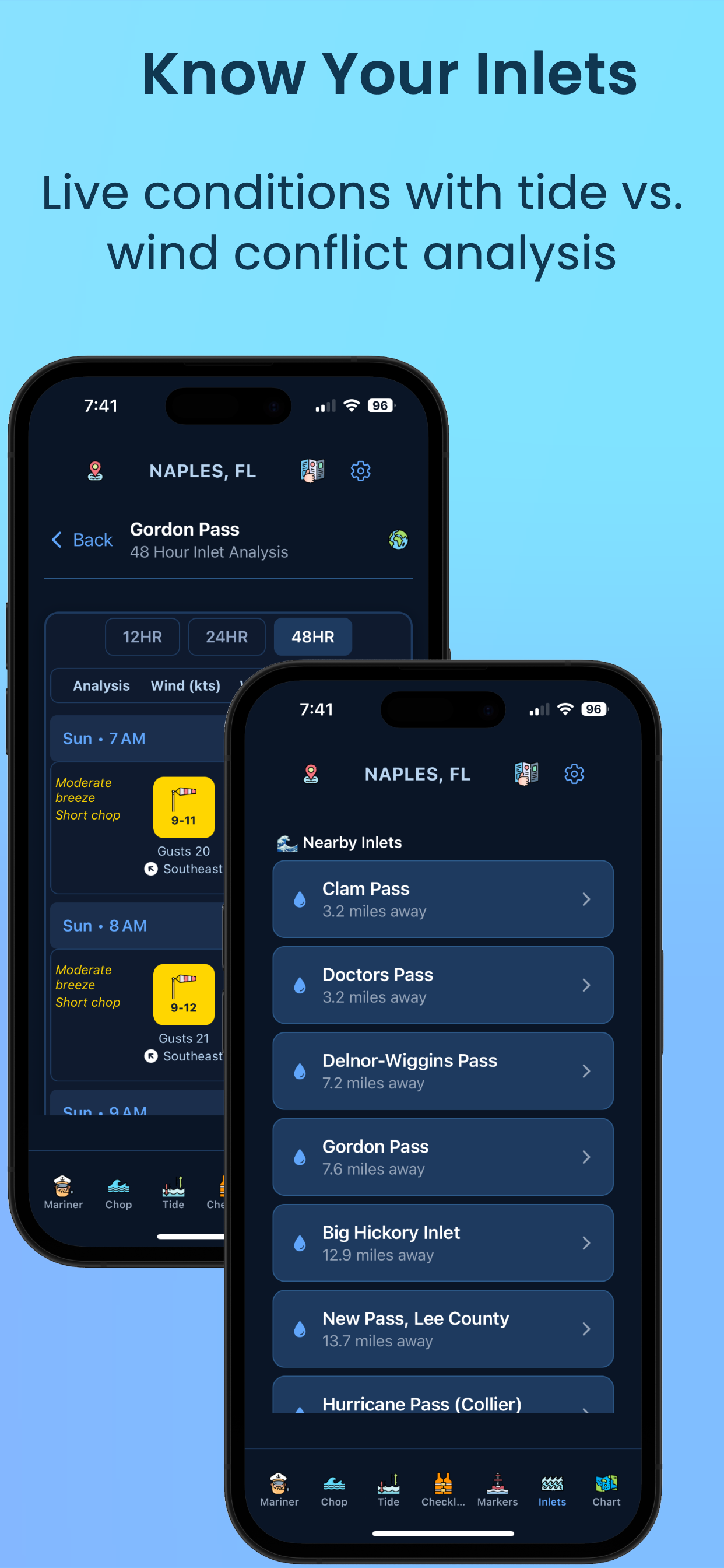
✓ 340+ Inlet Conditions
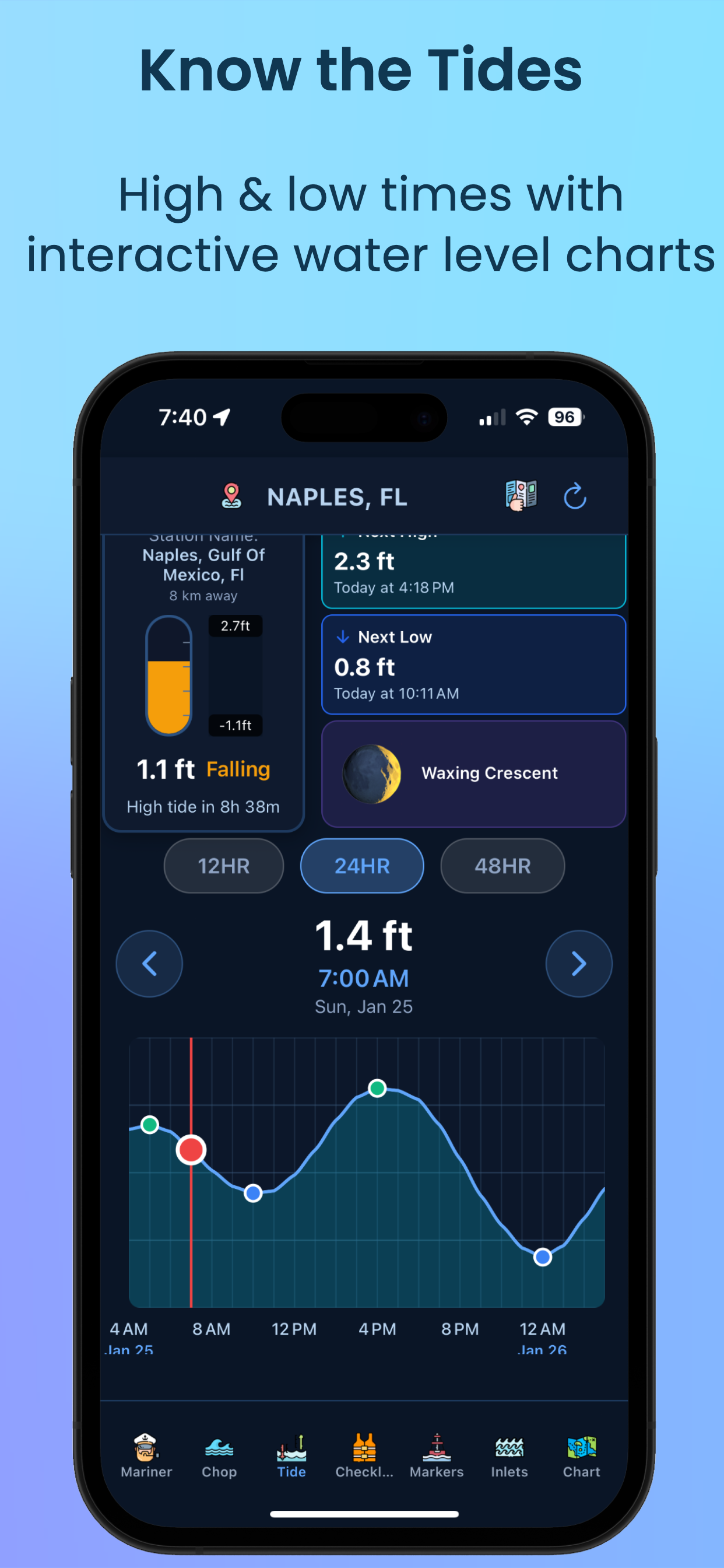
✓ 5-Day Hourly Forecasts
✓ Boat Profile Integration